Thursday, November 27, 2014

Rogans Gully

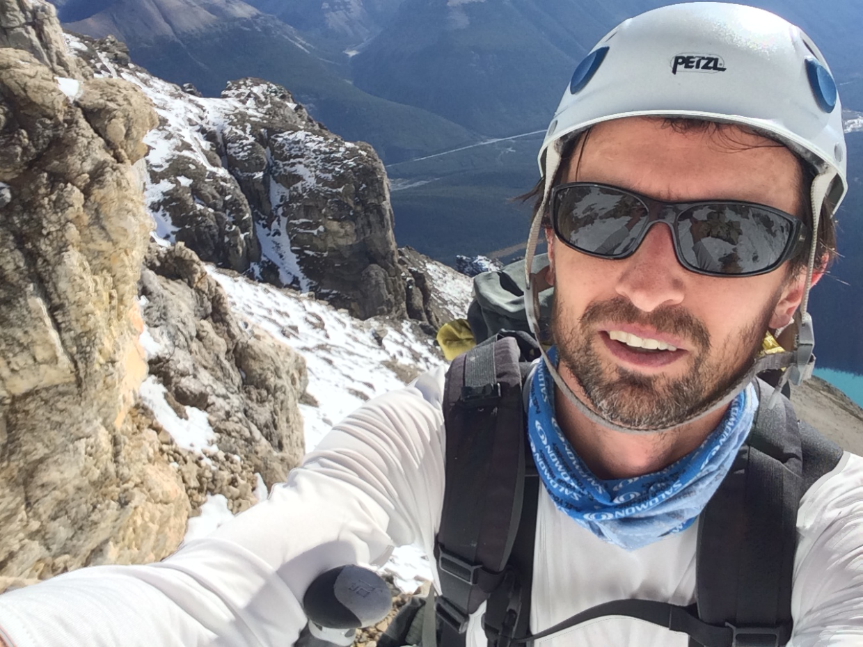
Climbed Rogans Gully on Cascade Mountain this weekend. Low snow accumulations in the terrain above this gully meant that it was free of avalanche risk. The route starts on low angled ice before a wide curtain of WI 2 ice. It then ascends a narrow 6 ft wide gully system with a mix of ice and dry-tool rock climbing. Turned around before the final ice curtain on account of darkness.

Thursday, September 11, 2014

Chephren

Went back for the third try on Mt. Chephren (3307 m.) this past weekend, likely the last nice weather of the summer. First try in 2005 we floundered along the shores of Chephren Lake, taking the wrong shoreline. Second try that same year had us up 90% of the way, but only 1 of our team the making the top. This time I took 4 hours the first day to navigate the lakehore - which consisted of bushwhacking and hopping from rock to rock on a giant boulder field.
Camped a few hundred meters above the lake on an old snowfield, the only reasonably flat ground I could find. After a long cold night I was happy to vacate the tent by 7 am. 5 hours of steady climbing on steep snowy and rocky terrain put me on the summit by noon. By the summit register only the 3rd ascent of the summer. Fantastic view all around, including Howse Peak and Whyte Pyramid right next door. 7 tedious, careful hours got me all the way back out to the car, picking up the tent along the way.

Tuesday, September 2, 2014

Moraine Lake Paddle

Judging by the strange looks we were getting from the hordes of onlookers, we completed what might be the first paddle board crossing of Moraine Lake. At the very least the first of the day. Great views of the Valley of Ten Peaks from a brand new perspective.

Friday, August 22, 2014

Mount Baker

BW and I crossed the border for a try on Mt Baker, which you can see from downtown Vancouver on a clear day. Late afternoon sunny skies as we started out along Heliotrope Ridge hiking trail, which starts a few miles east of the town of Glacier, WA. The trail eventually climbs up to a spot just underneath the Coleman Glacier. We don the crampons and start up the glacier headwall around 6 pm, slightly hurrying to get up to our intended camp before dusk. We camp in a large basin on the glacier around 7000ft. By 10 pm we are asleep from a hectic day of travel and hiking. Back climbing by 7:15 am the next morning, we slowly wend our way around the crevasses int he large glacier. A cloud is over the mountaintop, so we travel in misty whiteout conditions. After reaching the saddle between Coflax Peak and Baker, we continue up a rocky ridge and then a steepish snow slope before coming out on the summit plateau - the Deming Glacier which caps the volcano. Crossing that easily we arrive on a small rocky outcrop at 1 pm. After a few summit photos we commence the long plod down, pack up the camp and make our way all the way back down to the trailhead by 7:15 pm.

Saturday, August 9, 2014

Paddle Boarding the Bow

JD and me gave the brand new stand-up paddle boards a try this weekend. Put in at the Canmore Bridge in the early afternoon after dropping off a pick-up vehicle 20 kms east along Highway 1A. Worked our way downriver, passing fly fisherman, wildlife, campgrounds, logjams and mountain forests to a spot near Gap Lake.

Wednesday, October 2, 2013

Spain-Morrocco Bike

Dp and i tried a cycling trip in Spain and Morocco. Day 1 took us from Almeria to Laroles (106 kms, 10 hours). Nice riding along coast followed by hot afternoon and evening over some very tough hills. Day 2 we were on the road before dawn from Laroles to Granada, up over the highest pass of the trip - the Puearta de la Ragua. 4 hours of inching the bike along at snails pace, and a total of 11 hours for the day over only 103 kms. Day 3 we rested in Granada and explored the famous Allhambra.
Day 4 had us back on the road Granada to Antequera, an easier flat ride through the countryside, 100 more kms. Day 5 was through valleys and past some nice lakes and windfarms from Antequera to Ronda, 95kms and i nice ride.
Day 6 was the last in Spain, mostly downhill from Ronda to Gibralter on the coast. Explored the Rock of Gibralter.
Day 7 we hopped on a ferry for Northern Africa, landing in the spanish enclave of Cueta and biking on surprisingly great roads to Tetouen. Arrived inthe middle of a bustling Sunday Souq. Short day, only 60 kms. Day 8 was our last on the bikes, from Tetouen to Chechfhaouen. A remarkably tough day on horrible roads and with terrible traffic. 80 kms.

Thursday, December 27, 2012

Patagonia

Did a week hiking and camping in the Patagonian Andes around Mt. FitzRoy and the elusive Cerro Torre.  Stunning views, though not doing any real climbing this time around:

Sunday, January 29, 2012

Chantilly Falls

DP and I hiked an hour up Evan Thomas Creek at dawn to be first in the queue for Chantilly Falls (100m  WI 2).  The first pitch was steepish but straighforward, followed by medium ange up to the belay.  Second pitch got vertical for about 15m, some white knuckle moments, but good axe placements.  2 rapells down off trees to the right. 2 hours up and down - good day for the first waterfall ice in 3 years.

Sunday, November 27, 2011

Kiwi Bike Tour

Day 1 (Mt John: 15 kms, 2 hours)
My first bike day in New Zealand is a local ride out and back from the town of Tekapo.  The town is on the shores of Lake Tekapo, a giant turquoise glacial lake.  A few clicks west of town (which lies at 710m) is Mt. John.  In the span of 4 kms, the narrow and windy road switch-backs up through apline meadows and sheep herds to the summit at 1050m.  Views from the top are stunning, snow capped peaks in every direction.  Takes about 1 hr to ride up, 2 minutes to spin down...

Day 2 (Wanaka-Haast: 149kms 8 hours)
Started the day in Wanaka, the start of State Highway 6, which runs up the west side of the South Island.  The first 50 kms snaked along the shores of 2 giant mountain lakes, Lake Makea and Lake Wanaka.  The next 20 passed through sheep farms and mountain valleys, before ascending to Haast Pass.  The ecosystem changes significantly over the pass, going from arid mountains to tropical rainforests.  Hairpin turns on the descent through huge valleys with waterfalls on all sides.  The remainder of the day followed a river right out to the coast, and dinner in Haast.

Day 3 (Haast-Fox Glacier: 121kms 7.5 hours)
Riding along very remote and rugged coastal scenery today, mountains coming down to meet the Tasman Sea. Lots of tight turns and wind.  Great view from Knights Point.

Day 4 (Fox Glacier-Ross: 130kms 8 hours)
Mostly in Glacier country today, rode between Fox and Franz Josef glaciers with lots of hills in between. Crossed over the steep Fox and Omarau Saddles before a rainforest ride into gold-panning country.

Day 5 (Ross-Punakaki: 108kms 7 hrs)
Uneventful flat (and windy) farmland ride for the first 65kms, thought the highlight of my day was going to be the Big Mac in Greymouth.  But the last 44km along to coast were amazing - very rugged coastal scenery, could hear the waves crashing all afternoon. 

Day 6 (Punakaki-Murchison: 101kms 6 hrs)
Riding today along the Buller River in the Buller Gorge.  Uneventful day, excpet for a punch from a passing motorist...

Day 7 (Murchison-Richmond: 112kms 8.5 hrs)
One of the toughest days ive had on a bike.  After the first hour, it started pouring and just wouldnt let up. Fought tough headwinds the whole day, crossing 2 saddles in the process - Hope Saddle and then Spooner Saddle.  Happy to get a hot shower and beer after.

Day 8 (Richmond-Picton: 127kms 8 hrs)
Excellent day as my last riding day.  The rains stayed away and the ride wound along the coast before going up over 2 passes.  The final 40 kms were along Queen Charlotte Drive with incredible views of the Queen Charlotte Sound.  Rolled into Picton at 5:30pm, just in time for the ferry to Wellington.

Mt. Cook

In New Zealand for 3 weeks for a try on Mount Cook (Aoraki).  At 3752m, its the highest mountain in the country and, depending on how Austral-asia is defined, highest on the continent.  Its located in the Southern Alps of the South Island, a stunning range with giant glaciers and steep cliffs.  Given the fact that i'd be solo, I hired a guide - Marty Schmidt - a very accomplished climber whose guided all over the world, including Everest and K2.  They allow for 6 days since the weather is so variable.  Cold winds come up over the ocean from Antarctica and usually bring snow.  Mt. Cook is only 40 kms from the ocean, so by the time the winds hit they regularly gust up to 150kph. Weather on the mountain was very poor the first couple of days, so we played golf and went rock climbing to some crags on the eastern side of the island.   

Finally the winds calmed and we flew into the Alpine Club hut at 2200m.  The hut is perched on a ridge in the center of the range, and, although we were the only ones there, is the hub for trekking and climbing in the area. We organized our gear and set out Saturday afternoon up the heavily crevassed Linda Glacier on snowshoes.  After 4 hours we set up camp at about 2800m and slept for a few hours before leaving the tent at around 1 am.  Winds were light, and the sky was filled with stars.
After roping up and crossing the rest of the Linda Glacier, we ascended/traversed steep snow slopes to a location called the Shelf.  The first section of technical climbing was up a couloir of maybe 60 degree snow/ice. 3 or 4 pitches of our 60m rope led to the start of a section called the Summit Rocks.  At that point the sun started to rise over the peaks, and i realized just how steep and exposed the route was. The rocky section was 3 or 4 rope lengths of steep mixed rock and ice - again 2 ice axes were necessary.   We rested at the top of the rocks, then head out up the Ice Dome, at first a steep ridge that dropped off 2000m to the east, then finally snow slopes to the main summit at 8 am.  In respecting local Maori beliefs, we did as all climbers and did not stand on the very highest spot.  Weather was great and winds were low - we could easily see out to the Tasman Sea to the west.

A very long descent followed - slow going down the steeps with 10 or 11 rappels.  Picking up the tent on the way, we made it back to the hut at 5 pm, all told a 16 hour day.  We were able to catch a helicopter out just ahead of a fresh storm, and and hour later were settled in the Mountaineers Pub in Mt. Cook Village for steak dinner and celebratory beers. Excellent climb, one of the toughest i've done.

Sunday, August 14, 2011

Temple

GW and I decided on a climb of Mt. Temple (3553m), the highest scramble-able peak in the Canadian Rockies. Set off early and after some equipment glitches we make our way to Sentinal Pass for lunch. Higher above the pass, a narrow patch of snow takes us through the narrow rock gully that is the steepest part of the route. After clearing the yellow and grey rock bands, the summit comes into view.

Excellent views of the Valley of the Ten Peaks and Moraine Lake well below us. Perfect weather on top - bluebird day and not a breath of wind. 11 hours after starting we are back at the car, ready for a beer at the Post Hotel.

Monday, June 6, 2011

Snowdome

Ski-mountaineered up Snowdome (3452m) with Duncan this past weekend. Day 1 had us rope up on the toe of the Athabasca Glacier. Up past the end of the snowcoach road, under hanging seracs (only 1 collapsed) and up the headwall brought us to the vast Columbia Icefields. We contoured up right towards Snowdome, although the partial whiteout and lack of landmarks had us navigating mostly by GPS. We camped at 3100m on a small dug-out platform on Snowdome's southern slopes. After a windy night, we set out early from camp. Navigating again by GPS we eventually located the snow crusted measuring stick on the summit. After taking some measurements for the Candian Geographic Society, we took off the skins and flew down, needing only an hour all the way back to the foot of the glacier. Excellent trip.


Saturday, May 14, 2011

Hector (Winter)

Duncan and I ski mountaineered up Mt. Hector this weekend. On skis this is a Rockies classic one day ascent without the need for a middle-of-the-night alpine start. Skinned up through trees and over avalanche debris before carrying skis for a short steep gully. Reached the glacier at mid-day and roped up for the gradual climb to the summit rocks.
Shed the skiis 150m below the summit and bootpacked the rest of the way. Some iced-over rock required crampons for a short stretch. Very low visibility on the way down, but perfect snow and great turns all the way back down to the highway.

Thursday, September 30, 2010

Elbrus

Its been a 3-1/2 year hiatus for the 7 Summits. JD, Rob and Big Jon climbed Mt. Elbrus (5642m), the continental summit of Europe, back in the summer of 2005. Luckily Duncan was up for the challenge, so I did not have to go to Russia on my own. We arrive in the Baksan valley in early September. This place is a ski resort in the winter, so there are a number of Alpine style ski chalets and hotels, but with a run-down Russian feel. Azau is the name of this town, right at the foot of Mt. Elbrus. We are staying at a hotel furnished by the company that arranged for our visas, border zone registration, and climbing permits (Soviet red tape is endless).
Our first day is an acclimatization hike to neighboring Mt. Cheget. We ride a single person charlift half way up, then hike the remainder to the 3700m summit. Its a gorgeous day and we get our first views of teh volcanic mass of Elbrus, which towers above all the other peaks in the area.
The next day we are packed up and on the cable-car, which will take us all the way up to the bottom of the glacier at 3700m. We set up camp as best we can away from a mess of rusting scrap metal, dirty huts broken down snow-cats, and generally a fine mess of Russian junk. We set off in the mid-day heat for an acclimatization hike up the route. We get all the way up to the Pushtakov Rocks at 4500m before coming back down for a hot meal.

We hitch a ride up the mountain with some sight-seers on a snow-cat the next moring. Worried about a poor weather forecast for the next week, we stache the tent and decide to make our break for the summit. Its rushed, to be sure, but these weather windows can mean all the difference.

A long slow slog takes us up a steep snow slope before the route traverses left to a col between the east and west Elbrus summits. We take one of our few breaks in the day, glance at the clock, and decide that even though we are late in the day, the weather looks good so we are safe to continue. Another steep snow slope brings us to the summit plateau. A few hundred feet further and we are topped out! At only 4 days, this was one of the faster climbs. 4 down, 3 to go!

Wednesday, September 8, 2010

Calgary-Tofino

Set out to replicate JD's Edmonton-Vancouver bike ride from the summer of 2005, except leaving from Calgary and going out to Tofino on Vancouver Island.
Day 1- Calgary - Banff, 130kms
Day 2- Golden, 139kms
Day 3- Rest (golf in Golden)
Day 4- Revelstoke, 149kms
Day 5- Squilax, 145kms
Day 6- Rest (swim in Shuswaps)
Day 7- Cache Creek, 149kms
Day 8- Boston Bar, 129kms
Day 9- Mission, 142kms
Day 10- Horseshoe Bay, 92kms
Day 11- Sproat Lake, 88kms
Day 12- Tofino! 115kms

Wednesday, February 6, 2008

Lady Killer

Went to Golden this weekend. Dinner at the Moberly Mountaineer Inn and ice climbing on the itinerary. Climbed Lady Killer (Grade III), which is about 10 minute east of town along the highway. The first pitch, ice was strong for half but deteriorated into brittle chandelier type ice for the last 10m. Very exposed.

Second pitch was firm ice, in the sun...gorgeous day.

Friday, January 25, 2008

Riverside

Another ice climbing weekend in Golden, the routes here are so close to the highwway, the access is great. Under the highway bridge and along the railway tracks takes us to the base of Riverside (WI Grade III), a route with some vertical, some rolling ice. JD leads up nicely again on a colder day, then we downclimb repel off trees to the right. Icy rope today.

Friday, September 28, 2007

Assiniboine

We tried Mt. Assiniboine (3615m) in 2005, but we were'nt prepared. JD and me set off from Mt. Shark trailhead early Friday morning on September long weekend. 26km hike in to Assiniboine Lodge. We rendezvous with our climbing gear, which we had flown in via Heli, then continue around Lake Magog and the Gmoser Highway up to the Hind Hut. Set off at 2 am ahead of a few guides/clients, but are caught within a couple hours. We follow in behind. Very steep climbing in crampons over mixed rock and ice. This is some of the toughest technical climbing we've done on an Alpine climb.

By noon we are on the summit! The way down is slow. We reverse our route, sometimes downclimbing, other times rapelling where its too steep. Finally we stumble back to the Hind Hut at 6 pm....16 hour day, but very worth it. One of the best climbs we've done so far.

Friday, June 8, 2007

Andromeda

With a great weather forecast I take a weekday off work and JD and i head off for Mt. Andromeda (3450m). We sleep in the car near the snow-coach parkinglot, and are off to a midnight start over rocky moraines. The wind is up a little, and we start to lose interst, but we reach the glacier and the base of our route, the Skyladder. After roping up and crossing the bergshrund, Jr. leads up a fairly steep snowslope. The sun comes out halfway up, and the wind drops to zero - a perfect morning for climbing!We reach a plateau and traverse along the top of a ridge to the summit. Views are stunning in all directions - the Columbia Icefields, Mt. Columbia, and countelss Rockies Peaks. Not a single soul around us for miles. We work back down in a circuit, climbing to the Athabasca-Andromeda Col. A few rapels take us down stee snow slopes, and back down the the glacier below. We are back at the car by 2 pm - 14 hr day.Very good day in the Rockies.

Monday, January 8, 2007

Masseys

Slept in the back of the car in Field friday night, up early and hiked along the railroad tracks to an icefall on Mount Stephen, Masseys Curtain (Grade IV). We climbed a diagonal ice-ramp to get to mid-hieghtm, then set up a toprope to practice.After we were comfortable, JD led up to the top, one vertical pitch followed by one lower angled section.